 |
| |
Document 11:
[PMO neg. nos. 10265 and 20588] |
|
| |
|
|
| |
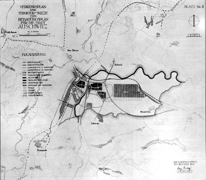
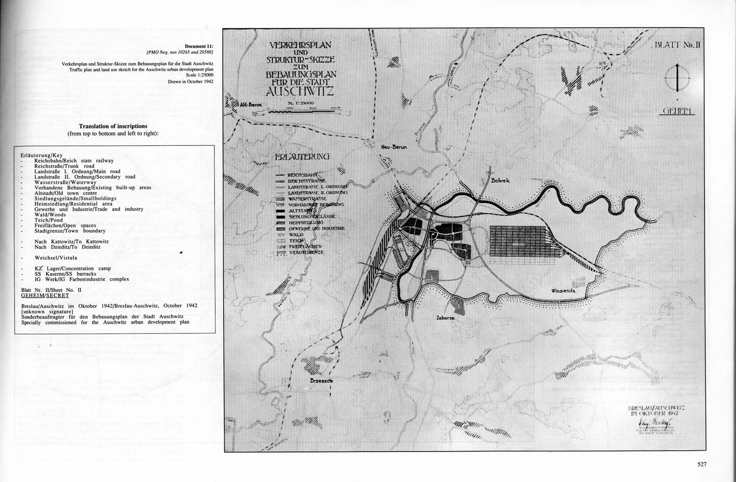
Verkehrsplan und Struktur-Skizze zum Bebauungsplan fur die Stadt Auschwitz /
Traffic plan and land use sketch for the Auschwitz urban development plan
Scale 1:25000
Drawn in October 1942 |
|
|
| |
Translation of inscriptions
(from top to bottom and left to right): |
|
| |
|
|
| |
Erläuterung / Key |
|
| |
· |
Reichsbahn / Reich state railway |
|
| |
· |
Reichsfraße / Trunk road |
|
| |
· |
Landstraße I. Ordnung / Main road |
|
| |
· |
Landstraße II. Ordnung / Secondary road |
|
| |
· |
Wasserstraße / Waterway |
|
| |
· |
Vorhandene Bebauung / Existing built-up areas |
|
| |
· |
Altstadt / Old town center |
|
| |
· |
Siedlungsgelände / Smallholdings |
|
| |
· |
Heimsiedlung / Residential area |
|
| |
· |
Gewerbe und Industrie / Trade and industry |
|
| |
· |
Wald / Woods |
|
| |
· |
Teich / Pond |
|
| |
· |
Freiflächen / Open spaces |
|
| |
· |
Stadtgrenze / Town boundary |
|
| |
|
|
|
| |
· |
Nach Kattowitz / To Kattowitz |
|
| |
· |
Nach Dzieditz / To Dzieditz |
|
| |
|
|
|
| |
· |
Weichsel / Vistula |
|
| |
|
|
|
| |
· |
KZ Lager / Concentration camp |
|
| |
· |
SS Kaserne / SS barracks |
|
| |
· |
IG Werk / IG Farbenindustrie complex |
|
| |
|
|
|
| |
|
|
| |
Blatt Nr. II / Sheet No. II
GEHEIM / SECRET |
|
| |
|
|
| |
Breslau / Auschwitz im Oktober 1942 / Breslau-Auschwitz, October 1942 (unknown signature)
Sonderbeauftragter für den Bebauungsplan der Stadt Auschwitz /
Specially commissioned for the Auschwitz urban development plan |
|
|

